On This Page
Table of Contents
Remote sensing involves gathering information about objects or areas from a distance, often from satellites or aircraft. This technology plays a crucial role in observing Earth’s surface without physical contact, making it invaluable for industries like agriculture, urban planning, and mining. Satellite Remote Sensing in Gold Mining involves using satellite-based sensors to collect data that can help identify mineral deposits, monitor environmental impacts, and enhance exploration accuracy.
The Role of Remote Sensing in Gold Mining
Gold mining is a complex process that demands precision, accurate data, and a thorough understanding of geological landscapes. Modern mining operations have greatly benefited from advanced technologies that enhance the way mineral resources are located and extracted. This guide explores how innovative tools and techniques, such as hyperspectral data and digital mapping, help gold mining companies discover new prospects and improve operational efficiency.
How Remote Sensing Works in Gold Minin
Remote sensing involves using specialized sensors to capture electromagnetic radiation reflected or emitted from the Earth’s surface. These sensors detect data across different wavelengths, which is then processed to generate imagery and maps. In gold mining, this technology helps identify specific minerals and track changes in the earth’s surface that may indicate the presence of valuable metals like gold. By analyzing these changes, mining companies can pinpoint areas with high exploration potential.
Key Components of Satellite Remote Sensing
- Sensors and Satellites: Satellites equipped with sensors like optical, infrared, and radar help in collecting diverse data types.
- Data Processing: The collected data is processed to create images and maps that reveal geological structures.
Hyperspectral Remote Sensing: The Key to Gold Exploration
Hyperspectral remote sensing is a powerful form of satellite imaging that captures data in hundreds or even thousands of narrow spectral bands. Unlike traditional RGB imaging, which captures three visible light bands (red, green, and blue), hyperspectral sensors capture a full spectrum, providing detailed insights into mineral composition and geological features.
How Hyperspectral Data Helps in Gold Mining
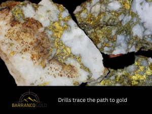
- Mineral Identification: Hyperspectral data allows gold mining companies to detect and map specific minerals in the Earth’s crust, which could indicate the presence of gold.
- Enhanced Exploration: By pinpointing potential mineral deposits, hyperspectral sensors reduce the need for extensive fieldwork and enhance exploration efficiency.
- Cost Efficiency: Remote sensing with hyperspectral imagery allows mining companies to cover larger areas without the costs of traditional surveying methods.
Advantages of Hyperspectral Remote Sensing in Gold Mining
- Non-invasive: No physical contact is needed, ensuring minimal disruption to the environment.
- High-Resolution Data: Provides accurate data that helps detect even small-scale mineralization.
- Wide Coverage: Satellites can cover vast areas, making it easier to scan remote or hard-to-reach regions.
How Remote Sensing Enhances Digital Mapping in Mining
Digital Mapping is the process of creating precise maps using data collected from remote sensors. Satellite imagery, combined with geographic information systems (GIS), provides a powerful platform for visualizing and analyzing gold-bearing areas.
Benefits of Digital Mapping for Gold Exploration
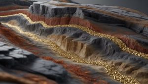
- Visualizing Geological Features: Detailed maps help identify faults, structures, and other geological features that may host gold deposits.
- Mapping Spatial Scale: Remote sensing data provides insights into various spatial scales, from local areas to regional scales, helping miners assess both large and small gold reserves.
- Environmental Impact Monitoring: Digital maps assist in monitoring changes in the environment as mining operations progress.
The Role of GIS in Gold Mining
By combining GIS with advanced data technologies, mining companies can create detailed 3D models of mineral deposits, conduct predictive analysis, and monitor ongoing exploration efforts. This integration allows for more accurate assessments of potential gold reserves, enhancing decision-making and improving the efficiency of exploration and extraction processes.
The Benefits of Remote Sensing in Gold Mining
Using remote sensing in gold mining offers several advantages that make the exploration process more efficient, accurate, and environmentally sustainable. This technology allows mining companies to quickly gather detailed data, improve resource identification, and minimize the environmental footprint of exploration activities. Enhancing decision-making helps optimize operations while reducing costs and risks.
Benefits of Using Remote Sensing for Gold Exploration
- Enhanced Exploration Accuracy: Satellites can detect subtle differences in mineral composition, making it easier to identify gold-bearing regions.
- Cost-Effectiveness: Remote sensing reduces the need for expensive fieldwork, saving money on exploration costs.
- Faster Decision-Making: With real-time data, mining companies can make informed decisions about where to focus their exploration efforts.
- Reduced Environmental Impact: Enabling non-invasive exploration helps minimize the environmental footprint of gold mining operations.
Common Mistakes in Remote Sensing for Mining
- Over-reliance on Data: While satellite data is incredibly useful, it should be combined with other geological methods for the best results.
- Underestimating Data Processing Needs: Hyperspectral data, in particular, requires advanced processing techniques and expertise.
- Ignoring Environmental Factors: Remote sensing can provide insights, but it’s important not to overlook on-the-ground environmental assessments.
Case Examples:
- Case Study: Gold Exploration in canada A mining company in canada used hyperspectral remote sensing technology to identify potential gold deposits in remote regions. By analyzing the spectral data, they discovered new gold veins that would have been difficult to locate using traditional exploration methods.
- Case Study: South American Gold Fields. In South America, remote sensing was used to create high-resolution maps of gold-bearing regions, significantly speeding up the exploration process and reducing operational costs for mining companies.
Tools and Technologies for Remote Sensing in Gold Mining
The right tools are crucial for extracting actionable insights from satellite data. Here are some tools and technologies commonly used in gold mining:
Popular Remote Sensing Tools in Gold Mining
- Sentinel Satellites: Sentinel-2 satellites provide optical imagery with high spatial resolution, useful for detecting geological features associated with gold.
- WorldView-3: A commercial satellite that provides high-resolution imagery, ideal for detailed mapping of mining areas.
- Landsat Data: Landsat satellites offer decades of historical data that can be used to analyze environmental changes in gold mining regions.
Trends and Future of Remote Sensing in Gold Mining
The future of gold mining looks promising. Technological advancements in sensors, artificial intelligence, and data analytics will further enhance the accuracy and efficiency of gold exploration.
Emerging Trends
- AI-Powered Data Processing: Machine learning algorithms are becoming more adept at analyzing complex satellite data, improving mineral detection and resource estimation.
- Increased Use of Small Satellites: The rise of small, cost-effective satellites is making remote sensing technology more accessible to smaller mining companies.
Clear Action Steps for Integrating Remote Sensing in Gold Mining
To integrate remote sensing into your gold mining operations, follow these steps:
- Understand Your Needs: Determine whether remote sensing is the right fit for your exploration and monitoring needs.
- Select the Right Tools: Choose the appropriate satellite imagery and data processing tools based on your geographical area and exploration goals.
- Hire Experts: Collaborate with remote sensing professionals and GIS specialists who can help interpret the data and create actionable insights.
- Combine Remote Sensing with Field Data: Use remote sensing as a complementary tool alongside traditional exploration methods to increase the accuracy of your findings.
- Monitor and Update Data Regularly: Continuously monitor your mining sites with updated satellite data to keep track of changes and potential new gold reserves.
FAQs
How accurate is satellite remote sensing for gold exploration?
Satellite remote sensing, especially hyperspectral data, is highly accurate when combined with ground-truthing methods and geological analysis.
Can satellite remote sensing detect all types of gold deposits?
Satellite remote sensing is effective at identifying surface-level mineralization and certain geological features that may indicate gold deposits.
How does hyperspectral remote sensing differ from regular satellite imaging?
Hyperspectral remote sensing captures data across hundreds of spectral bands, allowing for more precise mineral identification compared to traditional RGB satellite imaging.
Conclusion
Satellite remote sensing is a powerful technology that enables the observation and analysis of the Earth’s surface and atmosphere without direct physical contact. Using sensors mounted on satellites to detect and record reflected or emitted electromagnetic energy, it provides accurate, consistent, and large-scale data about natural and human-made features. Its role is crucial in numerous fields such as environmental monitoring, weather forecasting, agriculture, disaster management, urban planning, and climate change studies.